
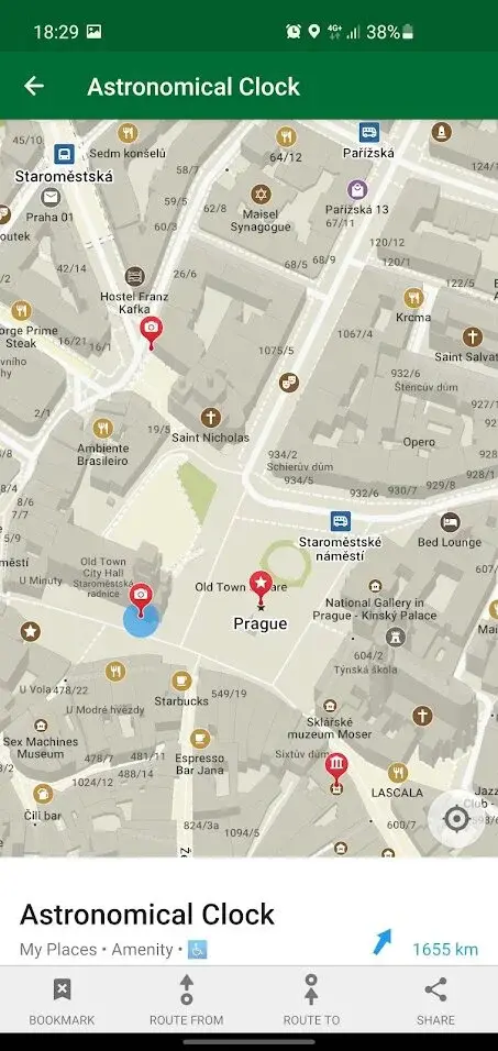
Organic Maps is one of the interesting applications for travelers, tourists, hikers, and cyclists based on top of crowd-sourced OpenStreetMap data. The UI is designed with the needs of outdoor users in mind with features like offline search ability, GPS recording of tracks & routes to share with others afterward, live tracking of friends or family when out adventuring together.
The app is recommended for anyone spending time outdoors in unfamiliar territory where they may not have internet coverage or frequent mobile signal reception. The map data is stored locally on their mobile device so it can be used while offline or without a cell signal. Users can download maps while they have access to the internet to avoid using up valuable storage space on their phone or tablet.

Wisepilot is an app that provides driving guidance for any day trip, whether it’s pre-trip or on-demand. You can use this software when you need to get around, whether it’s during your morning commute or while you’re on vacation. With its interactive features and high-quality user experience, it is easily the most competent navigation application out there today.
Wisepilot is that you can choose how you want to be guided on your trip. The app has multiple options for how it can show you which way to go. You can choose between a simple arrow or a full map with clear step-by-step instructions along with the mentioned shortest or longest route to the targeted location.

MAPS is an online platform enabling the users to locate their desired location in seconds. It works in multiple progressive steps like you need to download the new Maps app from the Store, press “Home” on your Apple Watch to get a view of your current location without having to open Maps first. Once you’re looking at a map, you can then swipe up or down to move around the neighborhood.
You’ll see navigation options appear as you go. If it’s time for dinner, press “Meal Options” and choose one of them from there. You can also use Siri to find specific locations which is not present in other alternatives. It facilitates you to find a nearby restaurant, a coffee shop with free Wi-Fi, or a hospital nearby, and more by tapping on the categories at the bottom of the screen. You can also search for destinations by name, address, or even phone number.

Magic Earth is a maps and navigation app based on OpenStreetMap data that you can install on your phone to see the world in a new way. The map has an endless landscape of scenery for billions of kilometers, including geographical features like lakes, mountains, volcanoes and cities which often come with zoom able views.
You can download it now to explore or be inspired by Magic Earth before you travel anywhere. By swiping left and right, you can navigate around the map like any other navigation app. With simple gestures, you can zoom in and out, switch between layers like traffic, choose between terrain or satellite images, and change the transparency of the UI element such as labels.

Openrouteservice is a website with a route service for cars, pedestrians, and bicycles based on Open Standards and Open Geodata. It has become an important tool for researchers, data journalists, NGOs, and governments. It is useful for mobility planning, analyses of traffic flows, or citizen engagement. The information provided by ORS can be visualized in maps, charts, or tables to better understand the state of our transportation systems.
Furthermore, it offers interesting 2nd layer services like GeoNode which allows you to store socio-economic data alongside the spatial data that are already available at ORS location points. Openrouteservice is a very handy tool for planners, researchers, and citizens to better understand mobility issues in their city or region. The different ORS services are available in three different languages like English, French, and German.

Navit is an open-source, modular, touch screen-friendly, car navigation system with GPS tracking. The navigation system can be used in any vehicle with a GPS receiver for tracking or downloaded as an offline navigator. There are three parts of Navit: the routing engine, the web interface, and the database.
The interfaces can be used by plugins. Plugins can be written in Python, C/C++, Java, or JavaScript. The routing engine is based on OpenStreetMap, which is updated with real-time GPS data from OpenNAv. This means that Navit uses only OSM data to calculate routes and does not use any other data sources or external services like google maps or even Nokia maps.

Arcane Maps is created by the Tor Project that provides privacy conscious access to their users’ locations, by anonymizing their physical address and routing them through a series of proxies. It’s called arcane because it uses no GPS tracking whatsoever it stores no personal data on its servers and works completely off-the-grid. You can visit your mapped location history to view what areas you’ve explored or for how long and no one else can see your history.
Arcane Maps is a free software program and network that helps you defend against traffic analysis, a form of network surveillance that threatens personal freedom and privacy, confidential business activities and relationships, and state security. It lets you anonymize web browsing and publishing, instant messaging, IRC, and other applications that use the TCP protocol. Its use is intended to protect the personal privacy of users, as well as their freedom and ability to conduct confidential communication by keeping their Internet activities from being monitored.

TomTom GO Mobile is a platform that allows you to experience the online navigation and locate the desired location with the single tap. Through offline maps and voice navigation, it provides detailed information on foreign countries that will even work when you’re in areas without data or Wi-Fi. It includes points of interest like restaurants, attractions, and more; no matter where in the world you are
TomTom’s easy-to-use maps that includes streets with street view. Use the app as a speed camera detector with support for Speed Cameras or improve your navigation knowledge to discover shortcuts around you. Other function of this platform includes discover new places and find what you’re looking for, locate nearby parking, petrol stations, restaurants and more, search points of interest by category to easily see a list of nearby results.

Locus Map is the world’s first offline, vector map application for mobile devices with a focus on outdoor activities. It includes routing, aerial photos and topographic maps from OpenStreetMap and other cartographers around the world. It provides built-in navigation with mapping so you won’t have to worry about battery life or data usage when navigating or orienteering.
Locus Map is used by all types of outdoor sports enthusiasts including hikers, mountain bikers, runners and orienteerers. It comes with 100 000 offline maps from all over the world making easy offline navigation on a phone. Other function of this platform includes it notifies you as an alert in the form of notification that reminds of upcoming geocache.

Graphhopper is a Ruby on Rails API for city directions that aids you to find the fastest way from one location to another. It’s highly optimized with thousands of data points from OpenStreetMap and even includes route optimization tools built-in. It follows the same API as Google Directions along with additional features that simplify directions at scale.
You can use this platform without having to design routes yourself, simply type in the two locations you want to go and it will provide the best route. Graphhopper is really great for finding routes for very short distances. The more distance between your starting point and ending point, the less accurate Graphhopper will be. However, it can still be used very effectively for finding routes within a certain distance range of 0 – 100km.

CoPilot is a platform that provides you real time access to different geological maps making you to locate the shortest route towards your target. With this platform, you get easy navigation straight from your dashboard without the hassle of switching between apps. This mapping service for commercial vehicles is rooted by map data and map-centric technology specifically designed for commercial vehicles.
The interactive trucking app offers many benefits over traditional navigation systems including improved fuel efficiency, improved situational awareness with near real time traffic information, industry leading routing features with up to date routes tailored for large trucks, improved safety features with trucker relevant services like truck stops and weigh stations.

Pure Maps is an application for Linux to display vector and raster maps, places, routes, and provide navigation instructions with a flexible selection of data and service. It provides routing information on supported services that supports multi-touch gestures for zooming in and out on the map, provides location based weather information including temperature, precipitation chance, wind speed, routing software for car navigation, proximity alerts based on your current location.
It comes with location based search for nearby restaurants and deeply integrated city search that uses Google Maps for better results. Other function of this platform includes bookmarks to save favorites locations. data providers support includes OpenStreetMap, Yahoo! Maps, Google Maps, and many others.

Sygic GPS, Navigation is the world’s most downloaded offline GPS navigation app. If you need directions for your country or region, you can get them easily and without internet connection. It provide you with the fastest and most precise routes possible on your Android smartphone or tablet device. It lets you to share your passion for traveling with friends and family with the Sygic web-based interface that offers millions of places just waiting to be discovered
It is available in English, French, Italian, German and Spanish language. The app can be used in offline mode, even without internet connection. It lets you explore millions of points of interest for over 200 countries around the world. It provides accurate navigation to your destination, detailed maps with live traffic information and an easy-to-use interface.

GMap.NET is a free, cross platform, open source .NET control that enables use of routing, geocoding, directions and Google map images. It is rich and easy to use with many features such as routing like driving or walking, geocoding locations with address or coordinates, directions, displaying user viewable locations with the ability to zoom in on the map for better detail.
It even provides stand-alone desktop applications so you can implement this control without ever touching ASP.NET. Whether you are looking for nearby coffee shops or bars or need step-by-step driving directions between cities, its navigation will get you there on time.

MapFactor Navigator is one of the first offline GPS navigation application that has been designed by drivers, for drivers. It is easy to use and works on any car or truck with an aftermarket car stereo that supports Android Auto. The only job is, simply connect the USB lead and plug it in. The app will automatically calibrate itself and start navigating you away from your camping spot to the nearest beer store.
You can use it in the rain with the raindrops on screen or in bright light conditions with auto-dimming of the background map. Switch between 2D and 3D maps for different views of the road ahead of you, individually switch different types of roads on/off depending on whether you’re driving on freeways or backroads.